
A cold front is pushing across Florida, funneling moisture across the peninsula on Tuesday. Deeper moisture will remain mainly focused across South Florida on Wednesday, while drier air begins filtering in from north to south, from the Panhandle through Central Florida.
This is a somewhat rare June cold front for Florida. What makes it special is that it will bring cooler temperatures, especially across the Panhandle and parts of North Florida, on Wednesday morning and possibly Thursday morning.
The dry air will be especially noticeable along the I-10 corridor and possibly into Central Florida by Thursday, making conditions feel much more comfortable.
Highs may only reach the low 80s in some areas, with mostly dry weather and east-northeast winds that could be strong at times.
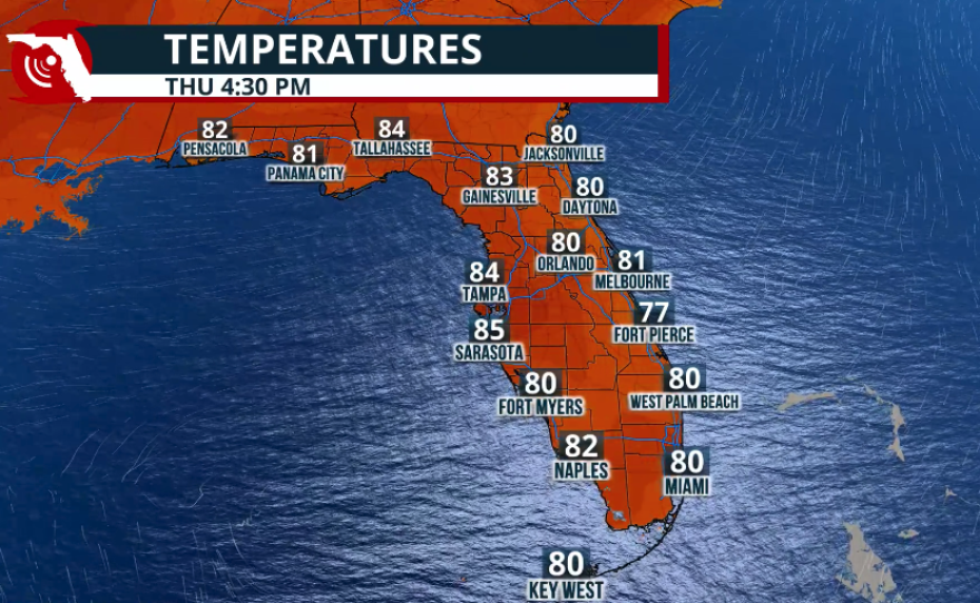

Across North Florida, temperatures will remain in the mid to upper 80s on Thursday and Friday, but humidity levels will be lower.
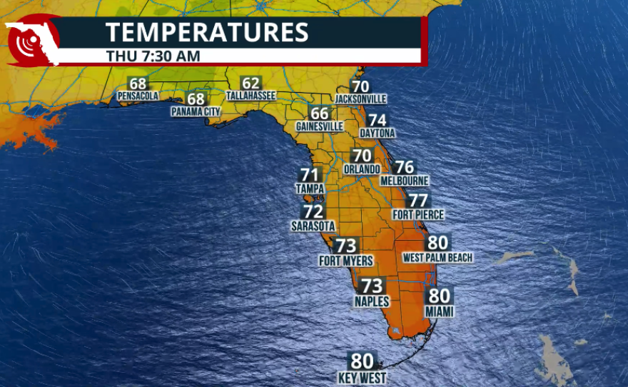
The coolest morning will likely be Thursday, when temperatures could drop into the low 60s around Tallahassee and across much of the Panhandle.
Winds on Wednesday afternoon will be mainly from the east-northeast, with gusts as high as 25 mph. With strong winds and dry air in place, please avoid fires or activities that could produce sparks, as fires could spread quickly.

Another concern will be hazardous seas as the front moves through and winds increase. A Small Craft Advisory is already in effect through at least Thursday morning.
Northeast winds along much of Florida’s Atlantic coast could reach up to 30 knots, with seas as high as 8 feet from the Space Coast through Northeast Florida.
Seas will also increase across South Florida, so boaters should monitor marine advisories from Wednesday evening through Thursday evening.
Rain Reports (thru 7:45 pm) with a Street Flood Advisory that includes the Miami metro area, until 8:30 pm. pic.twitter.com/FWJyaHo2qe
— 7 Weather (@7Weather) June 2, 2026
South Florida will remain in a soggy pattern on Wednesday and will still face a risk of flash flooding as the front inches closer.
Many areas of Southeast Florida received more than 2 inches of rain in just a few hours on Tuesday afternoon, as sea breeze activity, abundant moisture, and westerly winds produced strong-to-severe thunderstorms.
These storms brought heavy rainfall in a short period, leading to flooding in parts of Miami and Pembroke Pines, where several roads were affected.

South Florida will not see much of a drop in temperatures. Humidity is expected to remain in place through much of the week.
A slight decrease in thunderstorm activity may be possible on Friday if a deeper layer of Saharan dust moves over the area. However, enough low-level moisture will remain available to support scattered showers and a few afternoon thunderstorms.


