-
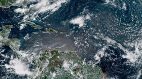 The Atlantic hurricane season is entering what is typically the busiest stretch, but an El Niño event is expected to suppress tropical activity.
 -
 While parts of Central and North Florida have seen heavy rainfall, many areas remain well below normal after two months of the rainy season.
 -
 In Florida, hurricane vulnerability is shaped not just by the storm, but by the way people live — in high-rises, along waterways, and across coastal communities.
 -
 A stationary front and deep moisture in the atmosphere will bring several days of downpours, keeping the threat of flash floods across the northern half of Florida this week.
 -
 Flash flood risk along Florida's East Coast, as there will be some slow movers. Higher rain chances remain focused over the areas experiencing the worst drought in Florida.
 -
 Temperatures could feel as high as 113F to start the week, with conditions changing later as more rain and storms return to the forecast.
 -
 Florida has one of the highest rates of air conditioning, with 99.5% of households reporting having access to cooling.
 -
 Tropical Storm Bertha made landfall north of the mouth of the Mississippi River on Wednesday. The threat for dangerous rip currents was expected to continue along the Gulf Coast.
 -
 The Peninsula had drier-than-usual conditions as Bertha was west of the state. The wind also left less hot afternoons across the western portion of the Peninsula, but as we wave goodbye to Bertha, rain and heat return to Florida. Let's look at this week's forecast.
 -
 Tropical Storm Bertha is producing dangerous surf and life-threatening rip currents for beaches along Florida's Panhandle.
© 2026 WFSU Public Media
WFSU News · Tallahassee · Panama City · Thomasville
Play Live Radio
Next Up:
0:00
0:00
Available On Air Stations


