-
 A flow off the Atlantic over the weekend and next week will lead to erosion, rough surf and the potential for flooding along the coast and nearby tributaries.
-
 By watching the clouds, they can help predict changes in the weather. Cirrus clouds often indicate a change in the weather is coming while cumulonimbus clouds indicate storms.
-
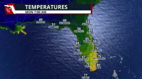 A cold front brings cooler air, lower humidity, and gusty winds
-
 A weak cold front will lower rain chances and also bring slightlly lower humidity values for much of Florida for part of this week.
-
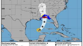 During a press conference Thursday, Governor Ron DeSantis said evacuations have already begun in low-lying areas close to the coast.
-
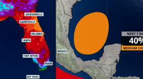 Gradual development is possible, but it will likely take the whole week for anything to take shape. Rain across Florida this week is due to a front and local effects.
-
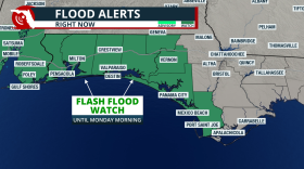 Tropical downpours are expected this weekend across the western Florida Panhandle. Local flash flooding will be possible
-
 The Atlantic has produced eight named storms in 2026—but no hurricanes. Here is how a strengthening El Niño helped create the historic lull and why the season’s shift matters for Florida.
-
 October weather across Florida is usually warm, with lower precipitation chances. The tropics usually remain a concern through the month.
-
 Florida finally has a meaningful opportunity to put a dent in its drought, but it could also bring localized flooding and increasingly rough coastal conditions into next week.

© 2026 WFSU Public Media
WFSU News · Tallahassee · Panama City · Thomasville
Play Live Radio
Next Up:
0:00
0:00
Available On Air Stations


