-
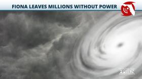
Hurricane Ian is just shy of Category 5 strength. It appears on track to slam ashore just north of Fort Myers.
-
Hurricane Ian is forecast to make landfall along the southwest Florida coast Wednesday as a major hurricane. It's now a category 4 storm.
-
Ian is forecast to parallel the southwest Gulf Coast before making landfall with the Sun Coast Thursday. Tornado risk increases from I-4 south today.
-
Ian is expected to continue rapidly strengthening. Landfall possible from the Big Bend to Sun Coast during the middle to end of the week.
-
Spaghetti models are a combination of different model ensembles. They are a simple way of communicating where a storm may travel given the data available at the time. Generally, they are used by meteorologists to give a geographical range to the public.
-
The tropical depression has formed in the Caribbean, and while the path could still change, Florida was in the forecast cone early Friday morning.
-
After Hurricane Fiona and Tropical Storm Gaston, another system could become a tropical depression this week as it tracks west.
-
Hurricane Fiona lashed the island of Puerto Rico over the weekend and early Monday, bringing several feet of rain across mountainous terrain.
-
Tropical Storm Fiona formed in the Atlantic late Wednesday evening and is expected to bring heavy rain and strong winds to the Leeward Islands late week.
-
As Hurricane Earl continues tracking northeast and farther away from the U.S., three other tropical systems are forecast to move out of the eastern Atlantic through early next week.
Play Live Radio
Next Up:
0:00
0:00
Available On Air Stations


