
Hang in there, Florida. We have another night of frigid temperatures ahead. New Year’s Eve will be cold, with some areas across the northern half of the state experiencing freezing temperatures, while the central and southern portions could see patchy frost.
The last day of 2025 has arrived, and the cold will dominate the Sunshine State. After the cold front moves through the state on Tuesday, the cold air will continue to sink in and remain very dry. Air over the state is preventing any showers or thunderstorms from developing.

The forecast for midnight indicates mostly clear skies across the state, with very dry air, low relative humidity, and wind subsiding. Even with less wind, you should be cautious if you’re planning on using fireworks. There’s plenty of dry vegetation around, and the low humidity levels could serve as fuel to any fires that get started.

Cold midnight!
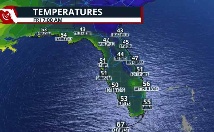
Temperatures around midnight will be in the low 50s across South Florida, while Southwest Florida will be in the upper 40s. Central Florida, including the Space Coast, will have temperatures around the low 40s, while North Florida will likely be in the upper 30s by midnight. The Panhandle is starting to warm up a little bit, especially across the western portion of the Panhandle. Cities like Pensacola could experience temperatures tonight warmer than those on Wednesday morning.
New Year's Day forecast
New Year’s Day will start on a cold note. Lows across the state could be near freezing in North Florida, which is why there’s still a freeze warning in effect tonight; it expires at 8 a.m. Thursday.
The frost advisory is in effect across the northeast coast through Jacksonville and Central Florida, except the immediate coast of the Tampa Bay area, and through the inland portion of South Florida, including Lake Okeechobee. Across these regions, temperatures could be near 32°F, which could promote frost. Please keep those sensitive plants indoors for one more night. Temperatures are expected to increase gradually as we approach the weekend.
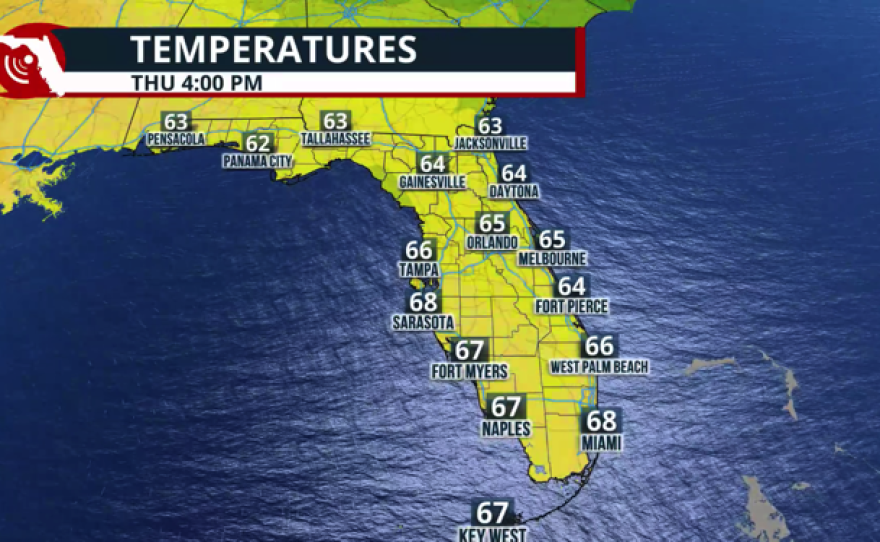
The highs for New Year’s Day will remain below average for this time of the year. South Florida will have temperatures around 10° below normal, in the upper 60s. Central Florida will remain in the mid-60s, and the same trend will extend along the I-10 corridor through Pensacola.

Is there another cold front on the horizon?
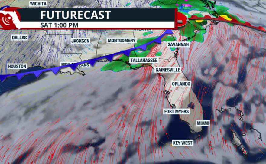
There will be a low-pressure system exiting in the Rockies on New Year’s Day. A low-pressure system will continue to move south over northern Texas, with two fronts attached. A warm front ahead of it will extend from the low-pressure system in Texas to the Florida Panhandle. Clouds will increase on Friday afternoon, and by Friday evening, showers will move from west to east across the Panhandle. Saturday could feature mostly cloudy skies and isolated showers.
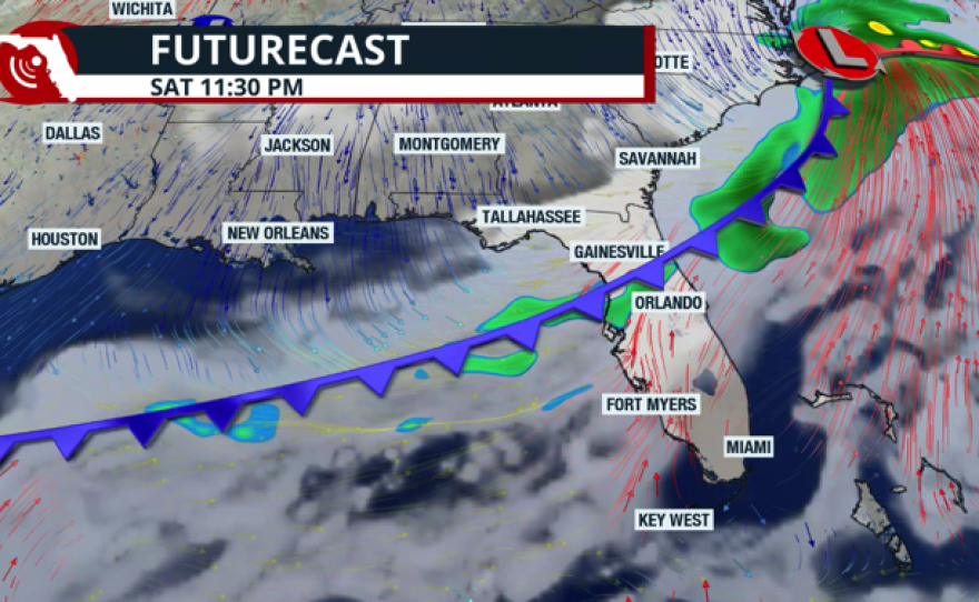
Following the movement of the low over the southeastern U.S., a cold front will push through Florida. This front is expected to bring rain showers across the Panhandle through Saturday mid-afternoon, and by evening, coverage will increase across North Florida and Central Florida. Unfortunately, for South Florida, the rain fizzles out, and we will remain with only a few more clouds to end the first weekend of 2026. We’re not expecting a significant cooldown from this front, but only a brief cooler air that will keep temperatures near normal during the afternoons and evenings.