The rain has not stopped across parts of South Florida on Sunday. This is incredibly beneficial for the soil, especially in western Miami-Dade and Broward, which are dealing with abnormally dry to moderate drought conditions, but not so much for those who still plan to be outdoors on Sunday. This rain is associated with a weak frontal boundary that is retreating northward and, with some sun peeking through at times, could produce heavier downpours and perhaps a lightning strike or two. The winds are strong, too, at times over South Florida, and are creating more dangerous conditions along the Atlantic coast. Small craft advisories are in effect through at least Sunday late afternoon, and a high rip current risk is in effect, likely to continue through Monday.
This frontal boundary will continue to move northward and increase instability across parts of Central Florida on Monday. Although South Florida will be a bit quieter than Sunday, scattered showers are still possible, mainly confined to coastal areas.

Florida will be sandwiched between two systems early this week. One weak frontal boundary is moving northward, and another cold front with a quick-moving low-pressure system that will pull lots of moisture from the Gulf.
Rain, associated with this next system and cold front, will start Monday late afternoon across Pensacola and spread over the I-10 corridor and the Panhandle overnight into Tuesday. The weather will begin to dry from west to east over the Panhandle starting Tuesday night, but move over North and Central Florida Tuesday afternoon into Wednesday.
Overall, up to 3 inches of rainfall is possible, especially across the central and western portions of the Panhandle, with this system. The front, although it will continue to bring showers over North and Central Florida, will not come as loaded with precipitation; therefore, about 1 inch of rain is forecast.
In South Florida, the front is unlikely to bring measurable rainfall. But it could see a very slight decrease in temperatures of about a degree or two on Thursday. This will be a welcome change from Tuesday afternoon, when temperatures will be in the mid-80s and humid, with winds from the South.
How about the change in temperatures?
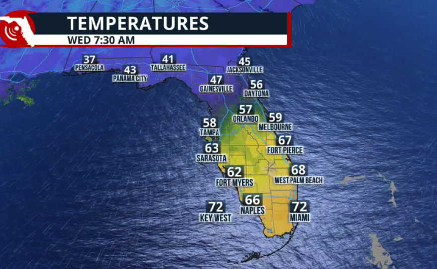
We forecast temperatures to be the coldest on Wednesday morning, dropping to the low-40s in the Panhandle and struggling to reach the mid-60s there on Wednesday afternoon as the cooler air filters through. Thursday morning will be another cold morning with lows in the low-40s.
For Central Florida, Thursday and Friday afternoon will be in the low-70s, and late-week mornings will be in the 50s. But the winds will shift late week as another system, similar to the one that passed early week, arrives in the Panhandle. Expect a click warm-up for Friday into the weekend.

South Florida will stay partly to mostly cloudy, but with southerly winds on Tuesday, temperatures will remain warmer than average and more humid. Temperatures will drop a few degrees on Wednesday and Thursday, with highs in the low-80s, but evenings will stay between the upper-60s and low-70s. Temperatures will approach the mid-80s again and likely surpass it on Friday and Saturday, as winds will be from the south-southwest as we await the next system moving through northern Florida over the following weekend.


