
Florida will continue experiencing unsettled weather over the weekend and next week. Tropical moisture from the Gulf of Mexico will keep the shower and thunderstorm activity in place, mainly moving from southwest to northeast, then west to east across the state throughout the weekend and into next week.
This moisture is courtesy of several systems. First, we have a stationary front that has started to move and retract to the east. We also have another low-pressure system, which is meandering across the Florida Panhandle and will continue to bring in lots of deep tropical moisture from the Gulf of Mexico. This system comes with a warm front first on Sunday and Monday, and then the actual low-pressure system will push through the Carolinas onto the mid-Atlantic states. We expect conditions to dry out briefly by the middle of next week.


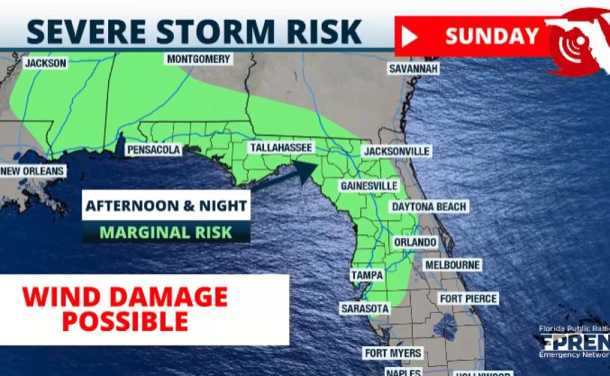
Heavy rainfall will continue to fall across the other half of Florida to start the weekend. On Saturday afternoon and evening, the severe threat will mainly focus on north Florida and the northern fringe of Central Florida. By Sunday afternoon and evening, the severe storms will be more likely across the Tampa Bay area, North Florida, and the Panhandle.


.
Rainfall will stay the highest across the Panhandle and Central Florida. However, parts of Jacksonville could also see rainfall exceeding 4 inches, with some isolated areas experiencing more than 5 inches. The rainfall decreases as we move near Lake Okeechobee and south. But keep in mind that the rainfall will start to pick up and increase as we move into the beginning of next week. The early models show rainfall across South Florida staying between 1 and 2 inches from Monday to Wednesday. We will bring you an update about South Florida rainfall during the weekend. It depends on the frontal boundary pushing through the state and how much moisture is squeezed away from this system.
This rainfall could help the dry situation, especially in the northern half of Florida, which is at least under a severe or extreme drought. But with the ground being so compacted due to the drought, high amounts of rain in a short time will struggle to drain. Please stay away from flooded roadways and stay tuned to the radar and local road closures.

With the chance for thunderstorms turning severe, keep at least three ways of receiving weather alerts. The storms that could turn severe could produce damaging winds, hail, and a brief tornado. Multiple lightning is expected. Remember, if you hear thunder, make sure you head indoors.