
An extensive low-pressure system over Tennessee and Kentucky drags a cold front that will enter the Florida panhandle between Saturday night and Sunday morning. This front will increase the chance for strong to severe storms, some of which could produce damaging winds overnight.
The rest of the Peninsula remained under mostly cloudy skies throughout much of Saturday. A few isolated thunderstorms have been streaming across the Peninsula, especially in the morning hours across South Florida. By the late afternoon, storms had lined up, mainly across the Everglades through Lake Okeechobee. Most of these storms will diminish and weaken, but a few isolated showers could make it over the metro areas of Southeast Florida.


Across Central Florida, there’s a low chance for isolated thunderstorms, mainly over Lake and Sumter counties. A few passing storms will affect I-95 between Jacksonville and Daytona Beach Saturday evening. The most intense thunderstorm activity will be moving along I-10 from Pensacola through Tallahassee tonight into the early morning hours on Sunday. This is where the chance for some strong to severe thunderstorms may develop. By the morning hours, conditions will be mostly stable across much of the state, with a few lingering showers across north Florida between Ocala and Gainesville. By the afternoon, shower and thunderstorm activity will pick up mainly along the eastern half of the peninsula from Jacksonville through Miami. A few isolated strong to severe thunderstorms, mainly in the afternoon hours, could produce some damaging winds.

Our very unsettled weather pattern with that wide low-pressure system will continue to spin just south of the Great Lakes area over Ohio and Indiana. The frontal boundary will try to make it as close to Central Florida as possible before a stationary front extends from this system to the next system, which will be located across West Texas on Monday.
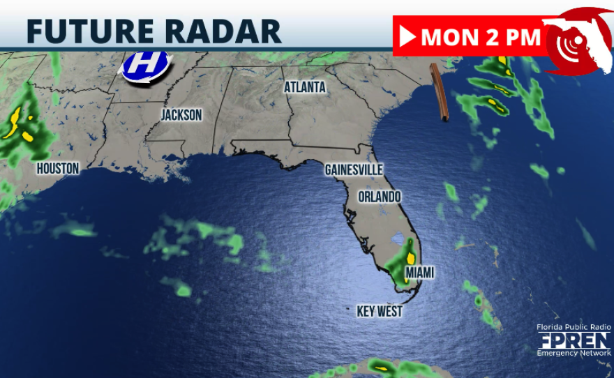
There could still be a few isolated storms across South Florida on Monday afternoon as a trough may try to develop across this area. On Monday, we will keep the highest chance for some isolated severe storms from Miami-Dade County through the Space Coast, passing over Lake Okeechobee.
A slightly dry air will settle in place for the middle of the week before the next low-pressure system moves in toward the end of the work week and next weekend. Before the next system arrives, the winds will be from the east between Tuesday and Friday, increasing the risk of rip currents over the East Coast of Florida. Please swim near a lifeguard.