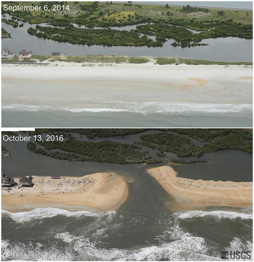
New photos from the United States Geological Survey illustrate the damage Hurricane Matthew dealt to Florida’s Atlantic Coast.
The aerial photography of Florida’s East Coast before and after Hurricane Matthew drive home the damage. While the effects are far less than meteorologist’s worst case predictions, the storm did wash away 15% of the sand dunes along the Atlantic Coast. Hilary Stockdon is a research oceanographer at the United States Geological Survey, and she says in some low-lying areas, Matthew cut islands in half, completely wiping the beach away and creating new inlets.
“In even lower areas along these barrier islands, waves and surge have cut completely across the islands and now water is flowing between the ocean and the inland water areas, effectively cutting this island in two,” she said.
Stockdon says much of the damage goes beyond normal wear and tear.
“Waves and surge are pushing over the dune and moving sand inland in what we call over-wash, sand is often deposited under houses or on roads. This is more of a permanent loss of sand to the beach because now the sand is out of the beach system, and it’s not available for natural recovery,” she said.
The U.S. Geological Survey is still gathering data on Hurricane Matthew to help coastal areas become more resilient. The question of whether to restore the eroded beaches is up to the affected communities.


