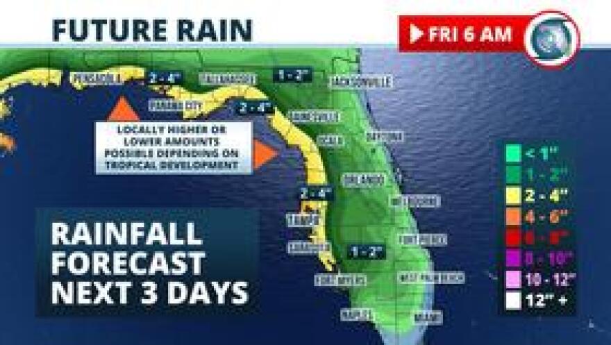
A tropical depression is likely to form in the eastern Gulf of Mexico, but the latest forecast trends may keep the worst of the weather west of the state.
Regardless of its exact track, 1 to 3 inches of rain may fall by Thursday in places along the immediate Gulf coast from near Fort Myers to Pensacola. Nearby seas will also grow unsettled, with minor coastal flooding and a high risk of rip currents expected.
The area of low pressure that is forecast to spawn the tropical depression or storm was near Tallahassee Tuesday morning, slowly drifting south. Upper-level winds are forecast to steer it into the northeast Gulf of Mexico Tuesday night, where conditions are favorable for strengthening.

Forecasters at the National Hurricane Center have been watching this system closely since late last week and place the odds that it will at least achieve tropical depression status at 80 percent.
The potential tropical development is projected to move slowly southwestward over the northeastern and north-central Gulf of Mexico through Thursday. The strength of two high pressure ridges, one over the southern Plains and the other over the Bahamas, will have the ultimate say on the exact track.
The most reliable global models forecast the high over the southern Plains to steer the tropical system westward away from Florida through Thursday. After that, a low pressure trough in the Great Lakes region may reduce the influence of this ridge. If it does, the second ridge over the Bahamas would cause the tropical system to turn northward toward the central Gulf coast near Louisiana. If the ridge over the southern Plains retains more influence, a track toward Texas would be more likely.
Since there is still a possibility the developing storm will turn north toward the central Gulf coast this weekend, we cannot confidently rule out squally weather in the western Florida Panhandle. The most likely scenario based on the latest available data is for the worst of the weather conditions and the direct effects of wind, rain, and surge to stay west of the state Friday into Saturday.
Potential Rainfall Next Five Days

The eventual track and strength of the disturbance will be a significant factor in how much rain falls over the next five days. Forecasters at the Weather Prediction Center are outlining areas along the immediate Gulf coast from near Fort Myers to Pensacola to receive 1 to 3 inches of rain through Saturday night. Areas farther inland may not receive much more than what typical afternoon thunderstorms produce in July.
The counter-clockwise motion of the wind around this feature will continue to send tropical moisture across the peninsula, but most of the rain should be confined to within about 25 miles of the Gulf coast from Fort Myers north and west to Pensacola. Not all areas will see torrential rain, but it is most likely in these areas.
Showers and thunderstorms will be more widely scattered across the rest of the state, but with also the potential to produce locally heavy rain, which is not out of the ordinary for mid July.
Specifics in any other hazards from the potential tropical system, such as coastal flooding or rough seas, are not real clear just yet. Even though confidence is high that a tropical storm will form, these details won’t be known until we have a better understanding on where it moves and how strong it becomes. Nonetheless, residents who live near the coast, particularly in the western panhandle from Panama City west to Pensacola, and in other low-lying areas are urged to stay informed of the latest forecasts with this weather system.
If the aforementioned disturbance is classified as a tropical storm as anticipated, it would acquire the name Barry. The first tropical cyclone of the 2019 season formed in May near Bermuda. A tropical storm forms, on average, two out of every three years in July across the Atlantic basin. Historical records from NOAA also reveal that a hurricane occurs in July only once every three years.
Copyright 2020 WUFT 89.1. To see more, visit .


